Metro Map Maker goes to the Library of Congress
Earlier this year I picked up a copy of Mark Ovenden's Transit Maps of the World. It's a delightful read and very fun to page through, and you're bound to find lots of inspiration for making your next map.
In the section on Washington, there's a small map captioned with "Detail from an 1880 map of street railways in the District of Columbia." The city's layout is easy to recognize, but the map is small, and there's so much detail that it's hard to tell exactly where the lines go.
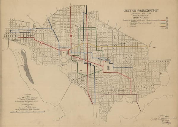
I really wanted to find out more about the old streetcar routes, and in order to re-create this map in Metro Map Maker, I'd need to see more detail. Transit Maps of the World cited this map as being from the Library of Congress collection, but how to find the map in the collection in the first place?
Squinting at the tiny map in the book, I managed to make out a few key details. This map was titled "City of Washington Statistical Map No. 10 showing the location of the Street Railways." I could also make out the map was "Compiled by Lieut. F.V. Greene, U.S. Engrs."
Searching on the Library of Congress website, I was pretty sure I found the map. Although I didn't find an image at first, everything else matched: the title, the date (1880), and F.V. Greene.
I really wanted to see the map in person, and one of the things I love about living in Washington DC is that I'm just a few short Metro stops from the Library of Congress.
Booking a research appointment at the Geography and Maps reading room was quick and easy – I requested the specific map I was looking for by name and call number, and asked if there were any other similar resources they could recommend.
When I arrived for my research appointment and checked in at the reference desk, they had an atlas waiting for me and a large table all to myself.
I'd been so excited to check out Statistical Map 10 that it didn't really occur to me that there were at least nine other maps to look at (in fact, there are 12). And the other maps are really interesting in their own right, even though the details are mundane:
- Property valuation
- Street grades, pavements, and street sweeping schedules
- Shade trees and gas lamps
- Water mains, sewers, and telegraph lines
- Public schools, police, and fire departments
And of course, Statistical Map Number 10:
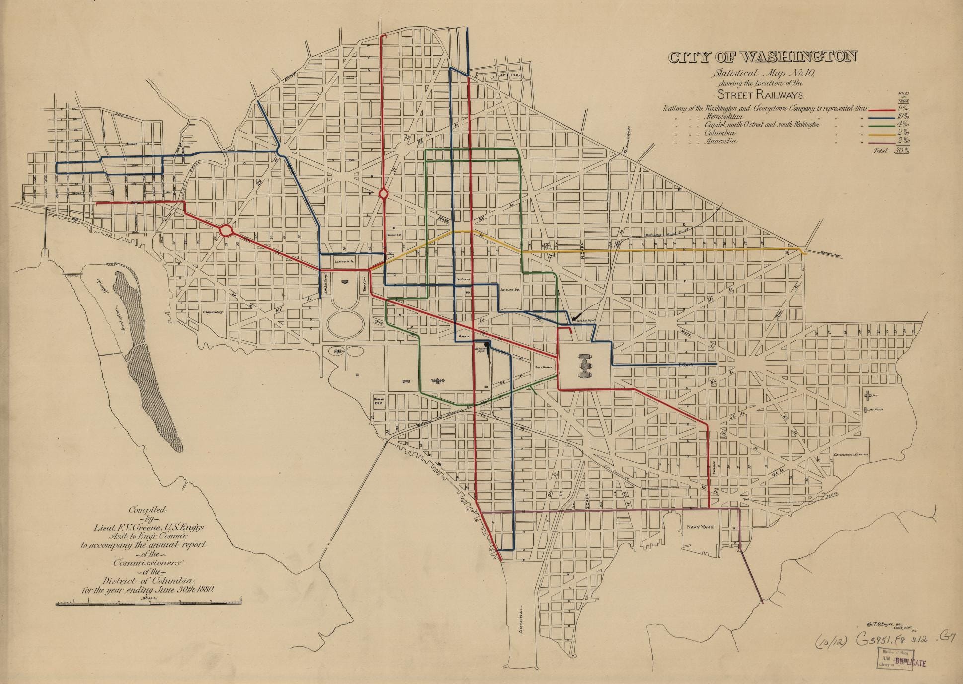
There are five streetcar companies shown, and the lines service:
- Along H St NE (where the DC Streetcar added in 2016 runs) from Benning Road (then Bennings Rd) to the Treasury
- Lincoln Square along East Capitol, around the Capitol to Union Station, LeDroit Park, the Patent Office, Lafayette Square, Dupont Circle, and Georgetown
- Pennsylvania Avenue, even between the White House and Lafayette Square, 14th and 7th streets down to the Waterfront, and the Capitol building down to Navy Yard
- A loop around the National Mall, Judiciary Square, and servicing the Capitol
- M St SW and SE to Navy Yard and points east of the Anacostia
My first thought was "look what they took from us", but that's not entirely fair. Most of the streetcars were replaced by another form of public transit (buses), and the buses even kept many of the previous route numbers (the #30, the #70). But I think we'd have a much more vibrant and dynamic city if we still had these streetcar routes in operation, and fewer private cars on the road.
Each statistical map in the series is like a time capsule, a fascinating look back in time to 1880. When I'd finished carefully paging through the atlas, I thanked the reference librarian and she asked if I'd like to see the other materials she had prepared for me.
I didn't know what to expect, but I was delighted when she wheeled out a cart stacked high with large folders full of maps and artifacts, including:
- Washington DC's suburban railway as of 1892
- Street Railways as of 1892, 1895, and 1912, with proposed extensions
- Proposals for rail extensions
- Original Washington Metro Area Transit Authority (WMATA) proposals and planned extensions
- WMATA brochures and newspapers
I'm hoping to highlight some of these in future posts; for now I want to share my favorite from that day.
My favorite artifact was from Andrew J. Campbell, Jr., a local engineer who wrote a colorful letter arguing for the region's need of a coordinated mass transit system in 1954. I'd noticed with some surprise that there was a paperclip holding the pages together; when I mentioned this to the reference librarian she was surprised, too – they don't use paperclips anymore because they can damage the materials.
I mention that detail because it suggests to me that this letter might not have been seen by anyone in a very long time.
Included below are my scans of the letter (it hasn't been digitized by the Library of Congress yet). I'm so delighted by this letter as well as the other proposed extensions and planning maps because it shows that the maps you're making on Metro Map Maker are a modern spin on something with a rich history: we're dreaming of a better world, one that we can have if we want it badly enough.
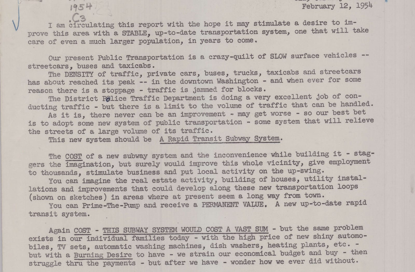

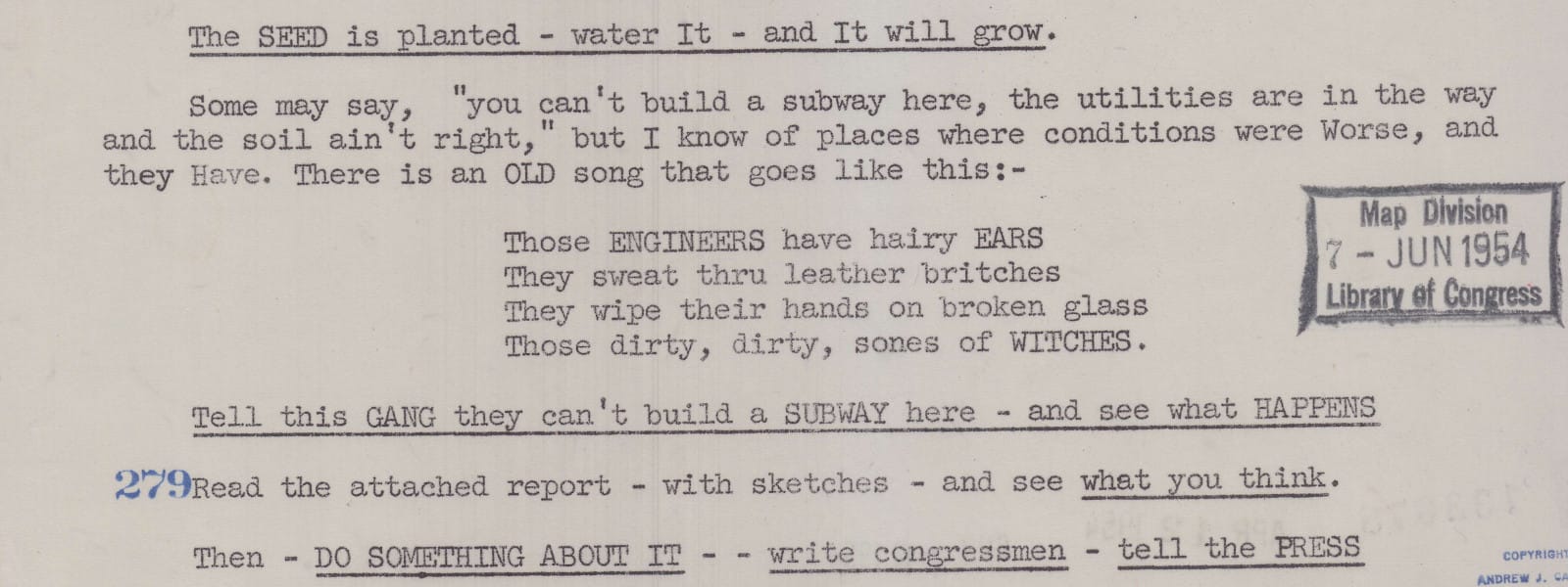
If anyone tries telling you not to include an off-color song in your appeal for a rapid transit system in your city, ask: is their letter in the Library of Congress collection?
They sweat thru leather britches
They wipe their hands on broken glass
Those dirty, dirty, sones of WITCHES.
Amazing stuff. I've included the rest of the scans here:
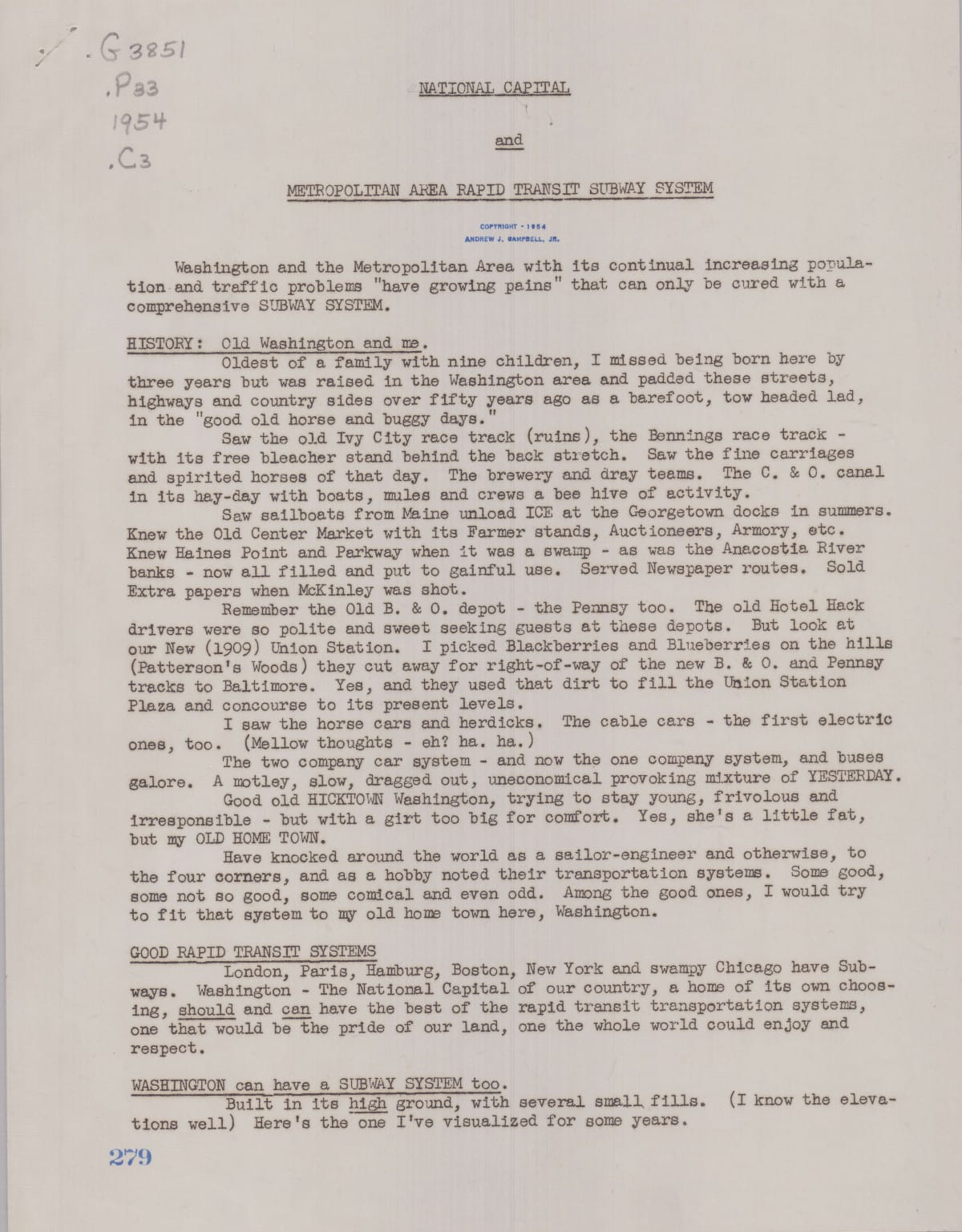
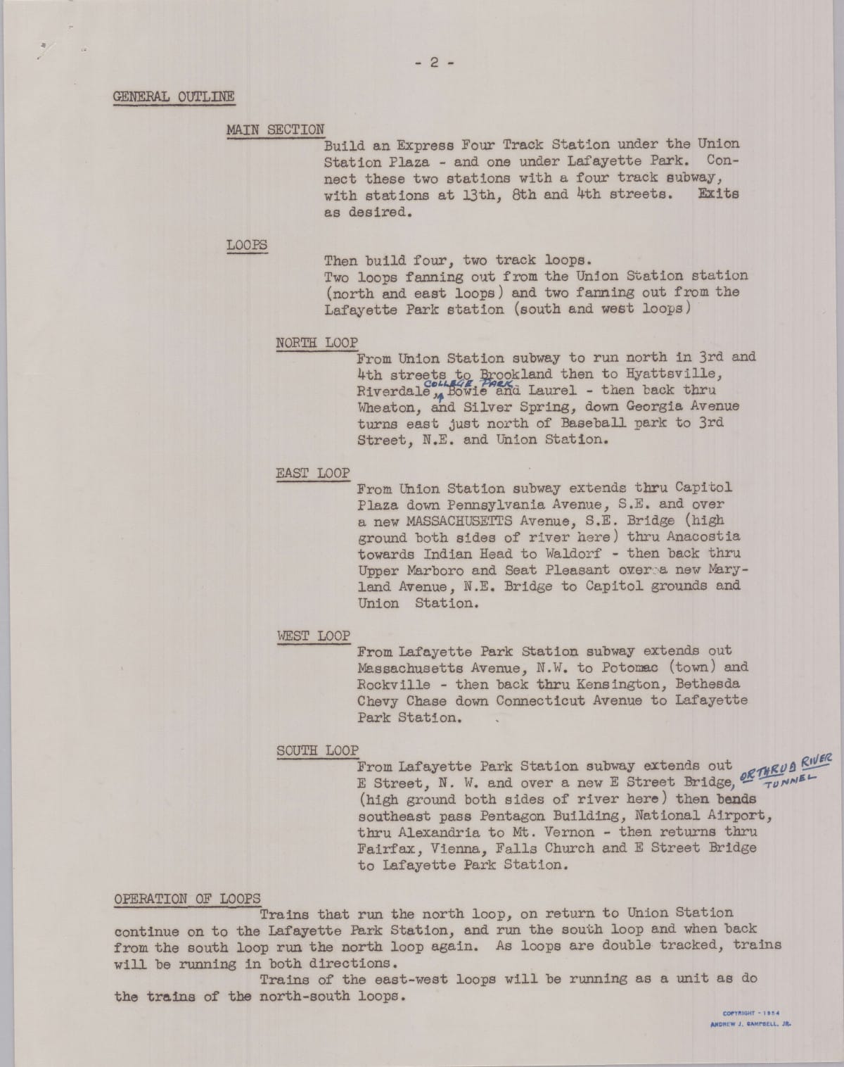
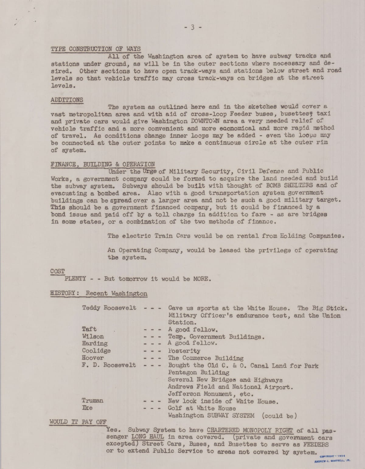
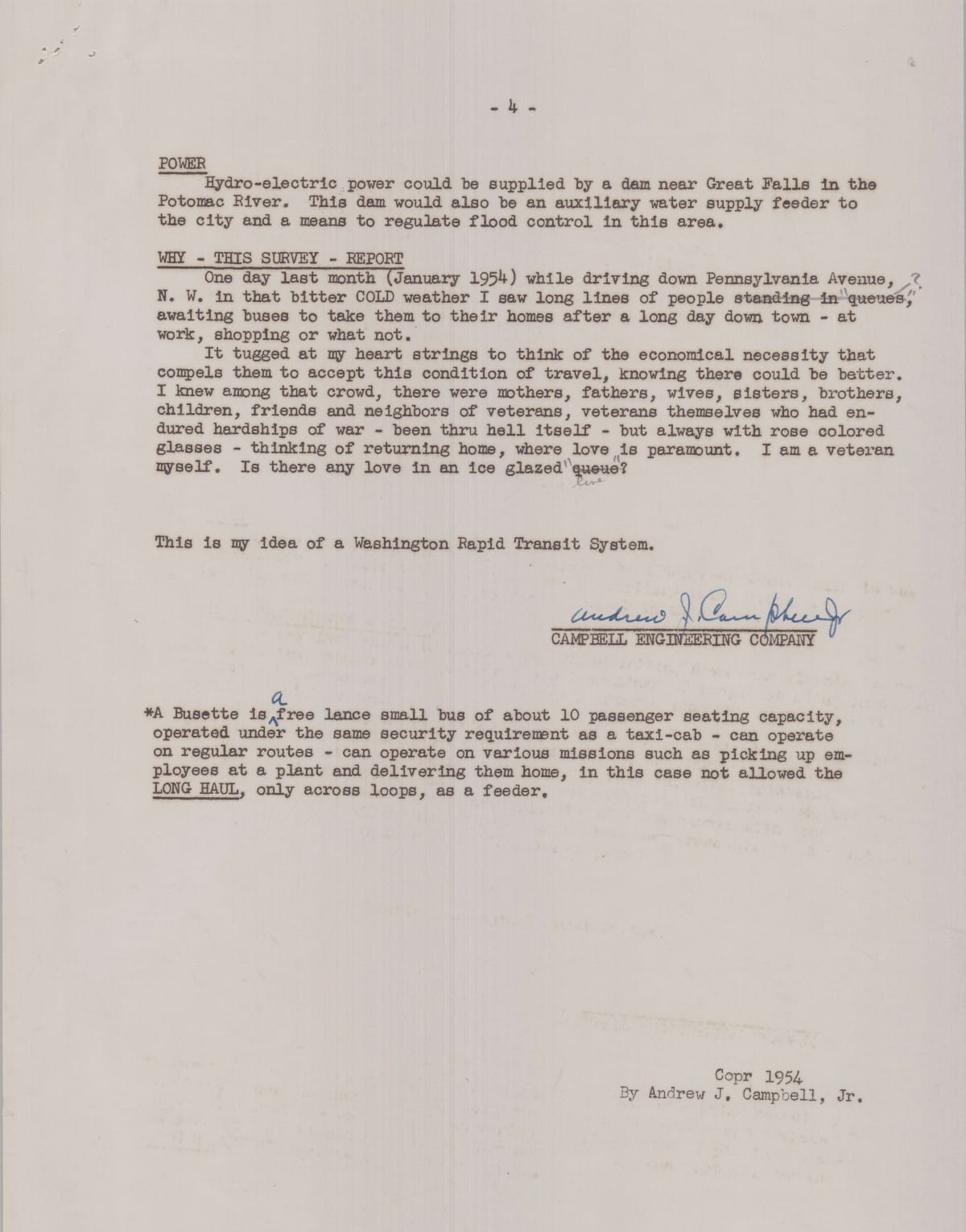
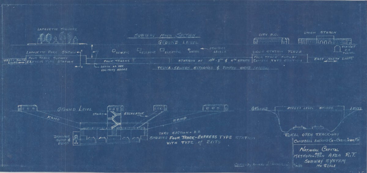
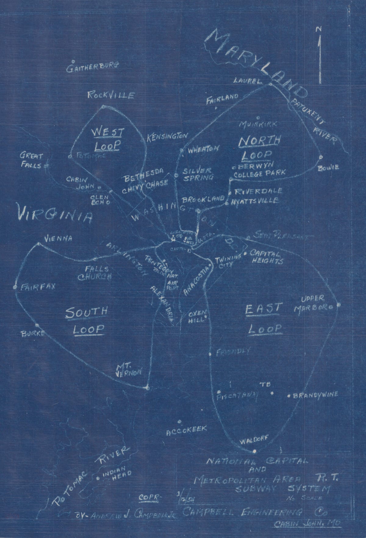
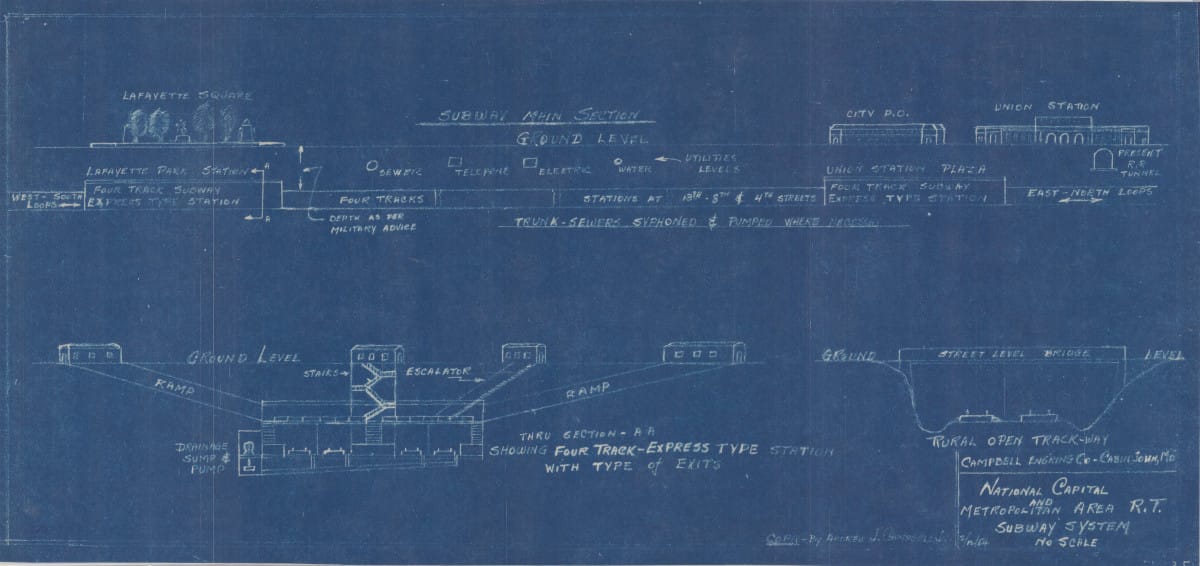
We could've had four tracks with express trains. We might never have known single-tracking. (Click each image to enlarge)
We didn't get four tracks with express trains let alone four loops, nor did we dam Great Falls for hydroelectric power. The Metro we have today is much more modest in scope, and not even as extensive as WMATA's original proposals.
But I love how ambitious and imaginative this proposal is. Reading between the lines, the fact that the writer mentioned cost so many times feels frustratingly familiar. Any time we expect more, we're always asked to justify the costs and answer "where will the money come from", but what are the costs of not building a more extensive system?
I say: keep making fantasy maps, keep expecting and pushing for more. Demand the "impossible," because a better world is possible. We just have to choose it.
A special thank you to the wonderful research librarians at the Library of Congress who made my first trip such a delight, and without their help I wouldn't have come across these resources in the first place.
I'm planning to write about some of the other gems from my trip as well. If you enjoyed this post, you might enjoy the others to come as well.


